Tellus
Tellus is a Fabric mod that recreates real-world terrain in Minecraft by generating Earth-scale landscapes from geographic data. It focuses on realistic elevation, biome placement, and climate-driven time and weather, aiming to make the world feel like a playable map of our planet.
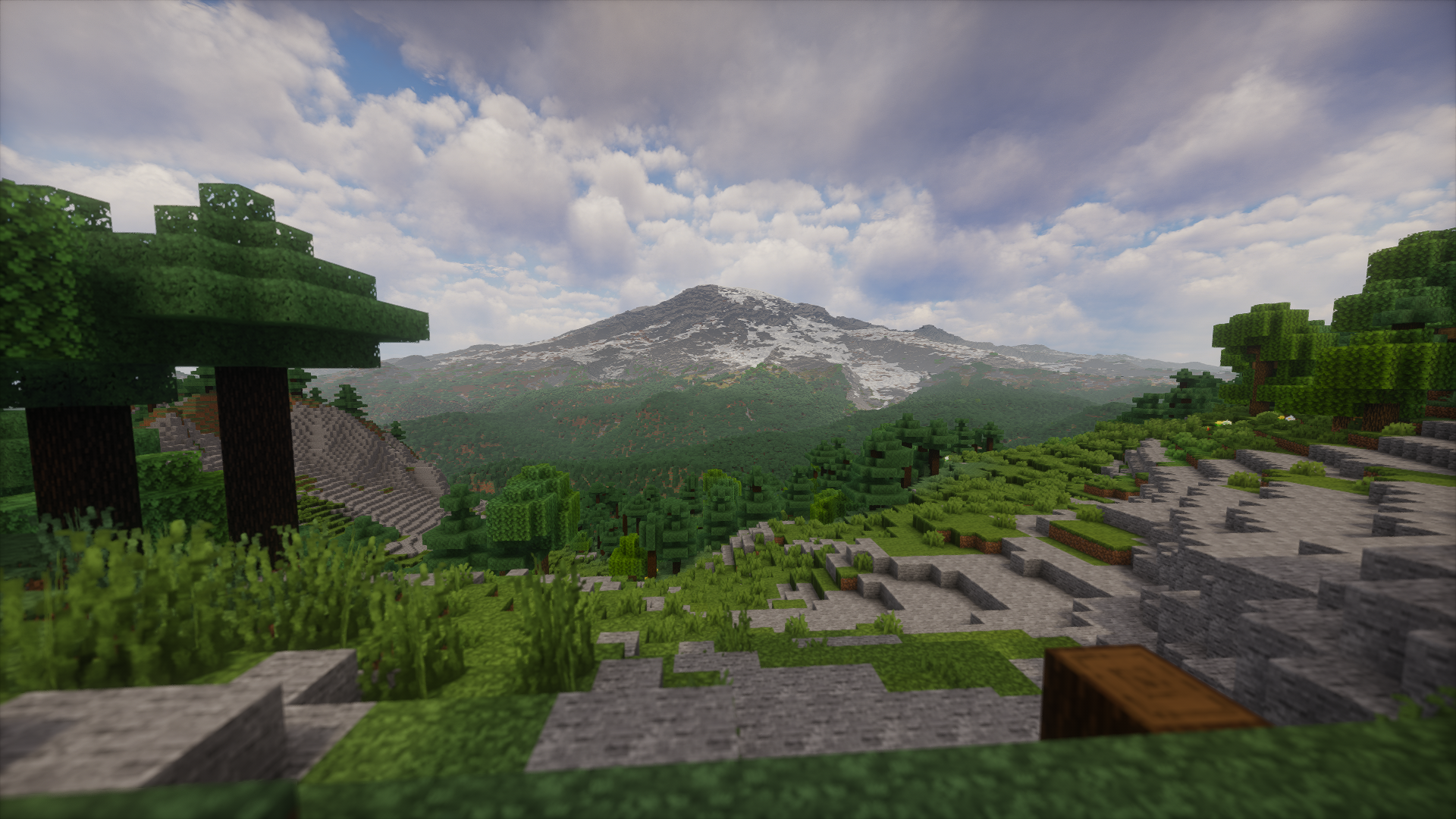
Inspired by Gegy's Terrarium: https://modrinth.com/mod/terrarium
Survival note: Some survival features are still missing (including certain structures and biomes). While a survival world is possible, upcoming updates may break those worlds; for now Tellus is better suited for testing and exploration than long-term survival.
Internet & data note: Tellus requires an active internet connection and will not work offline. It downloads terrain, land cover, climate, and weather data on demand; expect ongoing data usage that varies with how much of the world you explore.
Server support note: Tellus must be installed on the server, but is not required on clients. Official server support is not available yet; for now you should create the world in singleplayer first, then move that world to the server (with Tellus installed) so new chunks generate with Tellus.
Note: generative AI was used during the creation of this mod.
Features
- Earth-scale terrain generated from geographic elevation data
- Highly customizable terrain generation (scale, height limits, and more)
- Built-in terrain preview screen for visualizing settings before world creation
- Biomes placed to match real-world climate regions
- OSM roads, buildings, and map features generated with Arnis-derived logic
- Real-time inspired weather and time systems (optional)
- Distant Horizons integration for long-distance terrain rendering
- In-game map teleport UI for choosing real-world locations
Third-Party Code
Tellus includes code derived from Arnis.
Copyright (c) 2022-2026 Louis Erbkamm (louis-e)
Licensed under the Apache License, Version 2.0.
Source: https://github.com/louis-e/arnis
Distant Horizons Integration
Tellus integrates with the Distant Horizons (DH) mod to render planet-scale terrain far beyond vanilla view distance. When DH is installed, Tellus registers a DH world-generation override for Tellus worlds (DH API v4+), so distant terrain is built using Tellus data and settings instead of generic vanilla sampling.
- Fast mode: Tellus provides a custom LOD generator that samples its elevation, land-cover, climate, and water data directly to build distant terrain quickly and consistently with your world settings.
- Detailed mode: Tellus delegates to DH's chunk-based generator for far terrain, which is more accurate but significantly heavier on performance.
Because Tellus worlds are Earth-scale, DH is strongly recommended and is almost essential for comfortable exploration and long-distance views.
Offline Fast LOD profiling
The Minecraft 26.2 target includes a headless source-loading simulation for Fast LOD development. It uses experimental 1:1 true-height settings, prefetches the real elevation, land-cover, land-mask, Overture water/road/building inputs, and reports cold/warm sampling timings without starting Minecraft or creating a world:
./gradlew :mc262:simulateFastLodDataLoadingThe default 64×64 detail-11 pass spans 8192 chunks, matching a 4096-chunk render radius. Use -PsimDetails=0,6,11, -PsimGrid=64, -PsimLatitude=..., and -PsimLongitude=... to select a smaller profile. The task stores its isolated cache under mc262/build/lod-simulation-game; -PsimGameDir=... selects another cache for cold-run comparisons.
Commands
/tellus map: Opens the GeoTP map UI (requires gamemaster permissions)./tellus weather: Shows local Tellus weather and time information at your current position./tellus config weather enable_realtime_time <true|false>: Overrides the real-time time setting on the server (requires gamemaster permissions)./tellus config weather enable_realtime_weather <true|false>: Overrides the real-time weather setting on the server (requires gamemaster permissions).
More commands will be added over time.
Settings
These options are available in the "Customize World Generation" screen when creating a Tellus world.
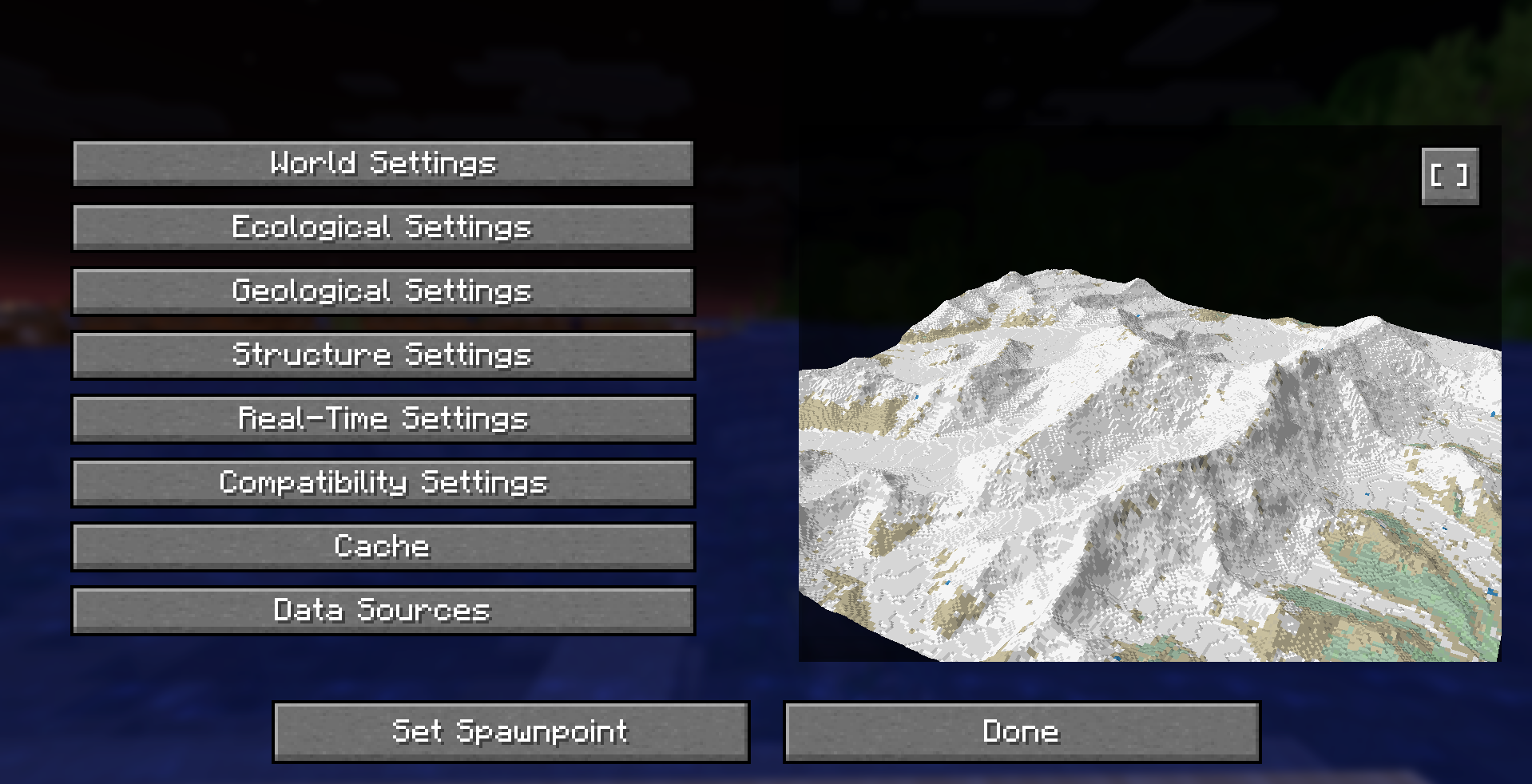
World Settings
- World Scale: Controls how many real-world meters are represented by one block. Lower values create more detailed, larger worlds; higher values compress distances and features. Current limits are 1:1m to 1:500m per block, with larger scales planned up to 1:40km.
- Increase Height: Enables the experimental true-height terrain profile. Hover over the option in-game for the current compatibility warning.
- Terrestrial Height Scale: Multiplier that converts elevation above sea level from meters to blocks. Higher values produce taller mountains and landforms.
- Oceanic Height Scale: Multiplier that converts elevation below sea level from meters to blocks. Higher values deepen oceans and trenches.
- Height Offset: Shifts all terrain up or down by a fixed number of blocks. Use this to raise or lower the entire world.
- Max Altitude: Upper world limit in blocks. Set to Automatic to let Tellus compute a safe cap based on your scale settings.
- Min Altitude: Lower world limit in blocks. Set to Automatic to let Tellus compute a safe floor based on your scale settings.
- Water: Uses Overture Maps
ocean/seapolygons as the sole ocean and coastline authority. Rivers and lakes retain their own Overture feature kinds, and ocean floors use OpenWaters bathymetry with a corrective coastal safety ramp.
Ecological Settings (work in progress)
These options are currently locked and not adjustable yet. They describe what will be configurable in a future update.
- Tree Density: Will control how many trees spawn in eligible biomes.
- Aquatic Vegetation: Will enable kelp and seagrass in water.
Geological Settings
The cave and underground generation system is still work in progress, so expect changes here.
- Cave Generation: Toggles underground cave generation.
- Ore Distribution: Enables vanilla ore distribution in Tellus worlds.
- Lava Pools: Enables underground lava pools.
Structure Settings
This section lets you toggle vanilla structures and world features on or off, such as villages, temples, monuments, ruins, and underground features like Deep Dark and amethyst geodes. Some structures (notably Deep Dark and certain ocean structures) may not generate properly yet and are still work in progress.
Real-Time Settings
- Real-Time Time: Syncs the in-game day/night cycle to real-world time based on your in-game location, so sunrise and sunset match that location's local clock.
- Real-Time Weather: Pulls live weather conditions for your location and mirrors them in-game (rain, thunder, or snow) instead of Minecraft's default weather rolls.
- Historical Snow Coverage (work in progress): Tracks recent temperature and snowfall data to decide if snow should appear and persist on the ground, creating more realistic seasonal snow coverage.
Compatibility Settings
- Distant Horizons Render Mode: Fast uses Tellus's LOD generator to build simplified distant terrain quickly with lower cost. Detailed asks Distant Horizons to use full chunk generation for far terrain, which is more accurate but significantly slower and heavier. For most setups, keeping Fast LOD generation is recommended.
- LOD Water Resolver: Adds water depth and smoother water surfaces to Distant Horizons fast LODs using cached Overture vector water without a coarse land-cover fallback.
- Coming Soon: Additional compatibility options are work in progress and currently unavailable.
Cache
- OSM data: Cached map, road, and water tiles used by Tellus map and OSM features. Deleting will force re-downloads as needed.
- Overture Maps land cover: Cached adaptive-zoom vector tiles used for biome and vegetation lookups.
- Koppen climate: Cached climate raster used for biome climate classification.
- Mapterhorn terrain: Cached elevation tiles used for terrain height sampling.
- OpenWaters bathymetry: Cached bathymetry tiles used for ocean and underwater terrain.
- Total: Combined size of all Tellus caches (read-only).
- Delete cache / Delete all cache: Removes cached data to free disk space; data will be re-downloaded or rebuilt as needed.
Data Sources
Overture Maps land cover
- Overture Maps base-theme
land_covervector tiles, selected at a zoom appropriate to the configured world scale and LOD resolution. - © Overture Maps Foundation. Base-theme license: ODbL.
- Derived from ESA WorldCover 2020: © ESA WorldCover project / Contains modified Copernicus Sentinel data (2020) processed by ESA WorldCover consortium.
- ESA WorldCover license: CC BY 4.0.
- https://docs.overturemaps.org/attribution/
- https://docs.overturemaps.org/schema/reference/base/land_cover/
- In-game processing: fetched with PMTiles byte ranges, rasterized to the world grid, and cached as compact tiles for fast lookup.
Overture Maps water
- Overture Maps base-theme water features provide inland-water geometry and definitive
ocean/seacoastline polygons. - Ocean classification does not use Mapterhorn elevation, land-mask state, or an elevation-at-or-below-zero heuristic.
- Complete empty vector tiles are valid dry coverage. Pending or failed coverage is kept non-cacheable so temporary source failures cannot become permanent dry seams.
- https://docs.overturemaps.org/attribution/
Koppen-Geiger climate classification
- Source: Beck, H.E., Zimmermann, N.E., McVicar, T.R., et al. (2018).
- Present and future Koppen-Geiger climate classification maps at 1-km resolution (Scientific Data).
- License: CC BY 4.0
- https://creativecommons.org/licenses/by/4.0/
- Publication DOI:
- https://doi.org/10.1038/sdata.2018.214
- In-game processing: reprojected and resampled to match the world grid, cached for fast lookup.
Mapterhorn terrain DEM
- Source: Mapterhorn global terrain tiles.
- Website: https://mapterhorn.com/
- In-game processing: sampled as Terrarium elevation tiles, with zoom selected from player scale and cached locally for reuse.
OpenWaters Seascape bathymetry
- Source: OpenWaters Seascape bathymetry raster DEM tiles.
- Project: https://github.com/openwatersio/seascape
- Tiles: https://tiles.openwaters.io/seascape/
- License: CC BY 4.0 for the published tile compilation.
- In-game processing: Overture
oceanandseapolygons define ocean membership independently of either elevation source. OpenWaters Terrarium pixels are bilinearly sampled at a zoom selected for the requested world/LOD resolution. Negative elevations are scaled by the oceanic height scale; zero or positive samples remain ocean and are clamped to a one-block minimum depth. Deterministic fallback bathymetry is used only when OpenWaters is unavailable. - Coastal safety: naturally shallow OpenWaters profiles are preserved. Abrupt, invalid, or missing profiles receive a smooth one-block-to-raw-depth ramp over 512 blocks by default. Configure it with
tellus.water.oceanFloorTransitionBlocks(0..2048); DH inherits this unlesstellus.dhWaterOceanFloorTransitionBlocksis supplied. The 512-block Overture coastline macro-tile cache defaults to 32 entries and can be set withtellus.oceanCoastCacheTiles(4..256). - DH renders the raw profiled ocean floor by default so deep-water variation remains continuous. Legacy logarithmic depth compression is opt-in through
tellus.dhWaterOceanDepthCompressionEnabled=trueand no longer uses a fixed maximum-depth plateau. - When raw bathymetry is deeper than the dimension permits, Tellus now fits it monotonically into the available vertical range instead of clamping every sample to the same bottom Y. Ocean floors reserve eight solid support blocks above the world minimum, configurable with
tellus.water.oceanFloorSupportBlocks(2..32). - Compatibility: the serialized
ocean_shoreline_blendsetting is retained but is a no-op for oceans. River/lake shoreline blending is unchanged.
Open-Meteo (weather)
- Weather data provided by Open-Meteo.com.
- https://open-meteo.com/
- License: CC BY 4.0
- https://creativecommons.org/licenses/by/4.0/
- Credit: "Weather data by Open-Meteo.com".
- https://doi.org/10.5281/ZENODO.7970649